Equinox Gold ⛏️
GIS Specialist
January 2022–present
MGIS Student at Penn State University🌍
GIS Specialist at Equinox Gold⭐
Geoscientist-in-Training⚒️
-PhotoRoom%20(3).png)
I’m Catherine — a passionate GIS specialist with over 5 years of experience spanning diverse industries. Currently based in Edmonton, Alberta, Canada.
My academic foundation is rooted in a Bachelor of Science degree with a specialization in Geophysics from the University of Alberta. Currently, I'm in the process of enhancing my professional prowess by pursuing a MGIS degree from Penn State University.
Apart from my professional life, I have an avid love for the outdoors which is mirrored in my hobbies. Snowboarding down the snowy slopes and testing my strength and skill in climbing/bouldering are how I recharge. The principles of patience, precision, and pushing past obstacles in these activities often resonate in my professional approach, ensuring that I give my best to every project.
This portfolio showcases my capstone project for the Penn State program – a testament to my commitment to constant learning and growth in the GIS domain. I invite you to explore and delve deeper into the intricacies of my work.
January 2022–present
August 2019–January 2022
March 2019–August 2019
April 2018–November 2018

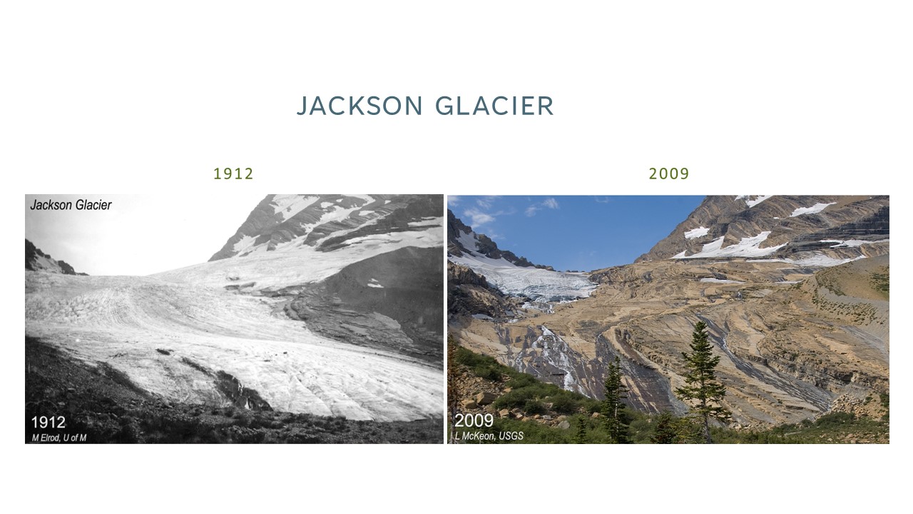
Study Area - Glacier National Park, MT


 Dilts, T.E. (2015) Spatial Average Two Polygons for ArcGIS 10.1. University of Nevada Reno.


Raster Calculator: Comparing Euclidean Distances

Raster to Polygon + Smooth Polygon


See the Pen Sperry Glacier by ZoeZelda (@zoezelda) on CodePen.

Are you interested in collaborating or want to connect? If so, hit the button down below to email me or contact me via LinkedIn🔗.
